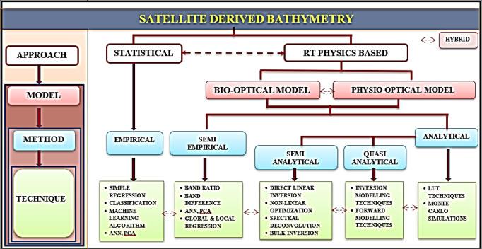
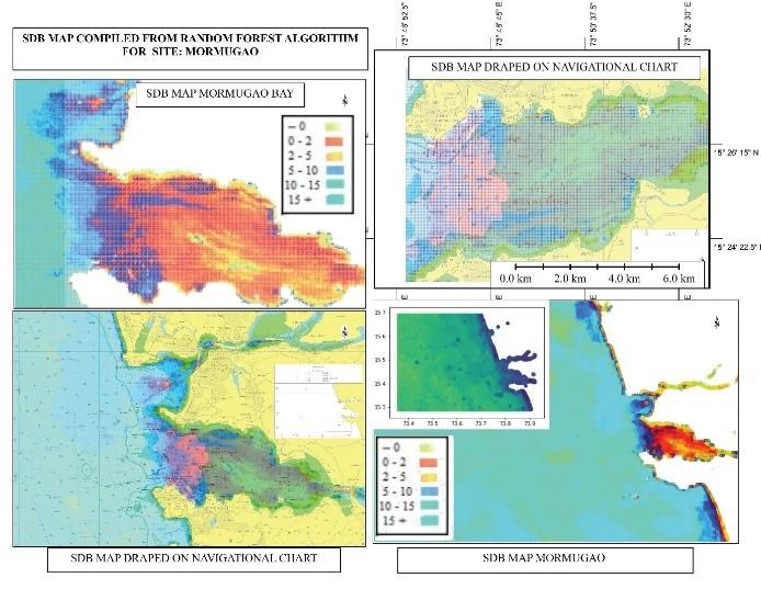
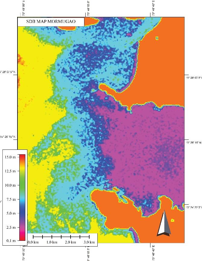
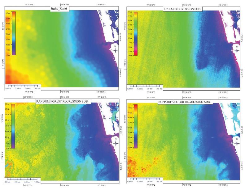
IMPORTANCE OF SDB
Marine Navigation: Satellite-derived bathymetry ensures safe navigation by providing accurate depth information, especially in remote or poorly surveyed areas.
Resource Exploration: It enables precise mapping of seabed features crucial for mineral exploration, fisheries management, and sustainable offshore development planning.
Environmental Monitoring: Facilitates continuous assessment of coastal erosion, sea level rise impacts, and marine habitat changes, supporting conservation and adaptation strategies.
Disaster Response: Provides rapid assessment of shallow water areas post-disaster for effective emergency response and environmental damage evaluation.
Climate Change and Sea Level Monitoring: Supports monitoring of sea level rise and coastal dynamics to aid in climate change adaptation and mitigation planning
Marine Protected Areas: Assists in MPA establishment and management by delineating boundaries and assessing habitat suitability for biodiversity conservation.
Mangrove Forest Conservation: Helps in mapping and monitoring mangrove ecosystems critical for carbon storage, coastal protection, and biodiversity conservation efforts.